|
|
Post by John on Jan 14, 2012 18:45:16 GMT -5
Probably Dick might shed some light on this one, how far north does the Yorkshire Coalfield extend???
Could there be coal beneath the Potash beds of far north Yorkshire???
The reason I ask, we had an anhydrite seam beneath the salt seam under our potash seam. The potash was about 15 feet thick, then 50 feet of rock salt, then anhydrite.
Now ICI was mining anhydrite near Middlesbrough, just the other side of the Tees was the Durham coalfield.
ICI's mines were not that very deep and the same beds that were beneath us at over 3000 feet!
Not sure if anyone has put boreholes down deeper than the potash beds in the Whitby/Boulby area.
|
|
|
|
Post by garryo on Jan 16, 2012 5:36:55 GMT -5
John
In the British Regional Geology series of books, one book Eastern England Tees to the Wash it states that "Everywhere in the region the Permian (strata) is underlain by Carboniferrous rocks (possibly,coal, shale ect)" The book goes on to mention that the Carboniferrous rocks have been traced far offshore, whether they are any economical workable seams the book does not state.
However you are right in assuming the that below the anhydrite would be coal bearing strata but at considerable depth.
I attended a lecture in Newcastle (UK) a couple of years ago which was discusing the subject of possibl re-opening collieries off the Durham and Northumberland coast namely Wearmouth/Westoe and Ellington north of the Causey dyke.
It was a very interesting lecture and if you wish via the forum I can give the salient points.
suffice to say their are still vast reserves at the fore mention collieries plus other resources (not reserves) farther south off the east coast of England.
Why the County Durham coalfield does not go further south is due to the structure of the basin which is synical in nature ie like a bowl with the lowest seam (Brockwell) cropping out under the Permian near Hartlepool. In the Boulby area a further basin like structure is found dipping South towards Whitby (and beyond).
|
|
|
|
Post by John on Jan 16, 2012 7:30:21 GMT -5
John In the British Regional Geology series of books, one book Eastern England Tees to the Wash it states that "Everywhere in the region the Permian (strata) is underlain by Carboniferrous rocks (possibly,coal, shale ect)" The book goes on to mention that the Carboniferrous rocks have been traced far offshore, whether they are any economical workable seams the book does not state. However you are right in assuming the that below the anhydrite would be coal bearing strata but at considerable depth. I attended a lecture in Newcastle (UK) a couple of years ago which was discusing the subject of possibl re-opening collieries off the Durham and Northumberland coast namely Wearmouth/Westoe and Ellington north of the Causey dyke. It was a very interesting lecture and if you wish via the forum I can give the salient points. suffice to say their are still vast reserves at the fore mention collieries plus other resources (not reserves) farther south off the east coast of England. Why the County Durham coalfield does not go further south is due to the structure of the basin which is synical in nature ie like a bowl with the lowest seam (Brockwell) cropping out under the Permian near Hartlepool. In the Boulby area a further basin like structure is found dipping South towards Whitby (and beyond). So it looks like there's a lot of coal reserves, but way out of reach to modern mining practices Garry. I know I read somewhere, that it is believed the UK seams are just a continuation of the European coal seams. |
|
|
|
Post by dickthecoal on Jan 16, 2012 13:12:29 GMT -5
John - I suppose I should be able to advise on this one but that's all I know is that the Yorkshire coalfield is entirely submerged. The north and south boundaries I know not. Ask me one on the Welsh coalfields weher I was educated and I'm your man but not Yorkshire I'm afraid. I suppose I was too busy trying to get out what was immediately in front of my eyes (or thereabouts)
|
|
|
|
Post by dazbt on Jan 16, 2012 16:21:07 GMT -5
John - I suppose I should be able to advise on this one but that's all I know is that the Yorkshire coalfield is entirely submerged. The north and south boundaries I know not. Ask me one on the Welsh coalfields weher I was educated and I'm your man but not Yorkshire I'm afraid. I suppose I was too busy trying to get out what was immediately in front of my eyes (or thereabouts) In my ignorance I've got to ask what is meant by "entirely submerged", is it a term relating to the original formation of the coalfield? |
|
|
|
Post by dickthecoal on Jan 16, 2012 18:13:42 GMT -5
The seams did not come to the surface at any point. In S Wales the seams outcroped at all four corners of the compass as the S Wales coal field was shaped like a soup dish with the deepest seams around the Pontypridd area. The seams dipped steeply in the south and emerged more gradually in the north.
In the North Eastern area (Ashington/Easington/Blyth etc) the seams outcroped under the sea hence the micro industry of sea-coal. Teams of men would be on the beach with horses and carts shoveling coal into the backs of the carts.
The Yorkshire coal field sits between two major faults in the west and east that throws the coal down
|
|
|
|
Post by dazbt on Jan 17, 2012 2:04:27 GMT -5
The seams did not come to the surface at any point. In S Wales the seams outcroped at all four corners of the compass as the S Wales coal field was shaped like a soup dish with the deepest seams around the Pontypridd area. The seams dipped steeply in the south and emerged more gradually in the north. In the North Eastern area (Ashington/Easington/Blyth etc) the seams outcroped under the sea hence the micro industry of sea-coal. Teams of men would be on the beach with horses and carts shoveling coal into the backs of the carts. The Yorkshire coal field sits between two major faults in the west and east that throws the coal down Thanks Dick, I thought that might have been what you meant. |
|
|
|
Post by garryo on Jan 17, 2012 5:40:28 GMT -5
As Dick states in North Northumberland the coal measures to the east crop out under the sea, hence the sea coal trade.
Further south in Durham the seams dip to both the south and the east. However past Seaham the seams start to slowly rise again. Therefore the deepest part of the synical basin is off Sunderland. From just north of the Tyne the coal measures start to be overlain by the younger Permian strata, east of Sunderland the coal seams continue dipping slowly eastwards until about 12miles offshore they begin rising again, until most of the upper seams outcrop against either the sea or the base of the Permian.
In the Seaham area there are some domal structures which limited the development of Dawdon and Easington plus a major south east fault.
All this info was revealed at the meeting I attended in Newcastle.
About the lecture/meeting, this was called by various interested party's incuding union people, local NE councilors , learned people and mining consultants.
The main points were:-
Over 200 million tons of coal that could be recovered by conventional methods in seams ranging from 1.5 to 3 metres although the greater tonnage was in the 1.5 to 2 metre range.
Coal rank varied from industrial to some coking reserves.
Area of access was between South of Sunderland to the mouth of the Tyne in other words the old Wearmouth/Westoe takes and in the deepest part of the syncline.
Some of the many problems that would need to be addressed were:- Access, both former collieries demolished and shafts filled. Most infrastructure removed ie rail access, waste dumping areas.
Immense capital required to re-develop, this would probaly need a new surface drift located in a green or brownfields site.
The Nimby factor along with the environmental issues, lack of political will from any political party of any shade from blood red to true blue and even "new pink".
Lack of trained miners, lack of venture capital owing to the huge capital required and long lead time for return on capital etc.
And last but not least 20,000 Wunderland supporters not wanting to see the " Stadium of Light" have two winding towers as goalposts!
A more promising area was in the old Ellington lease north of the Causey Dyke. Probally less capital required (also less tons), but all previous issues apply
|
|
|
|
Post by dazbt on Jan 17, 2012 7:17:34 GMT -5
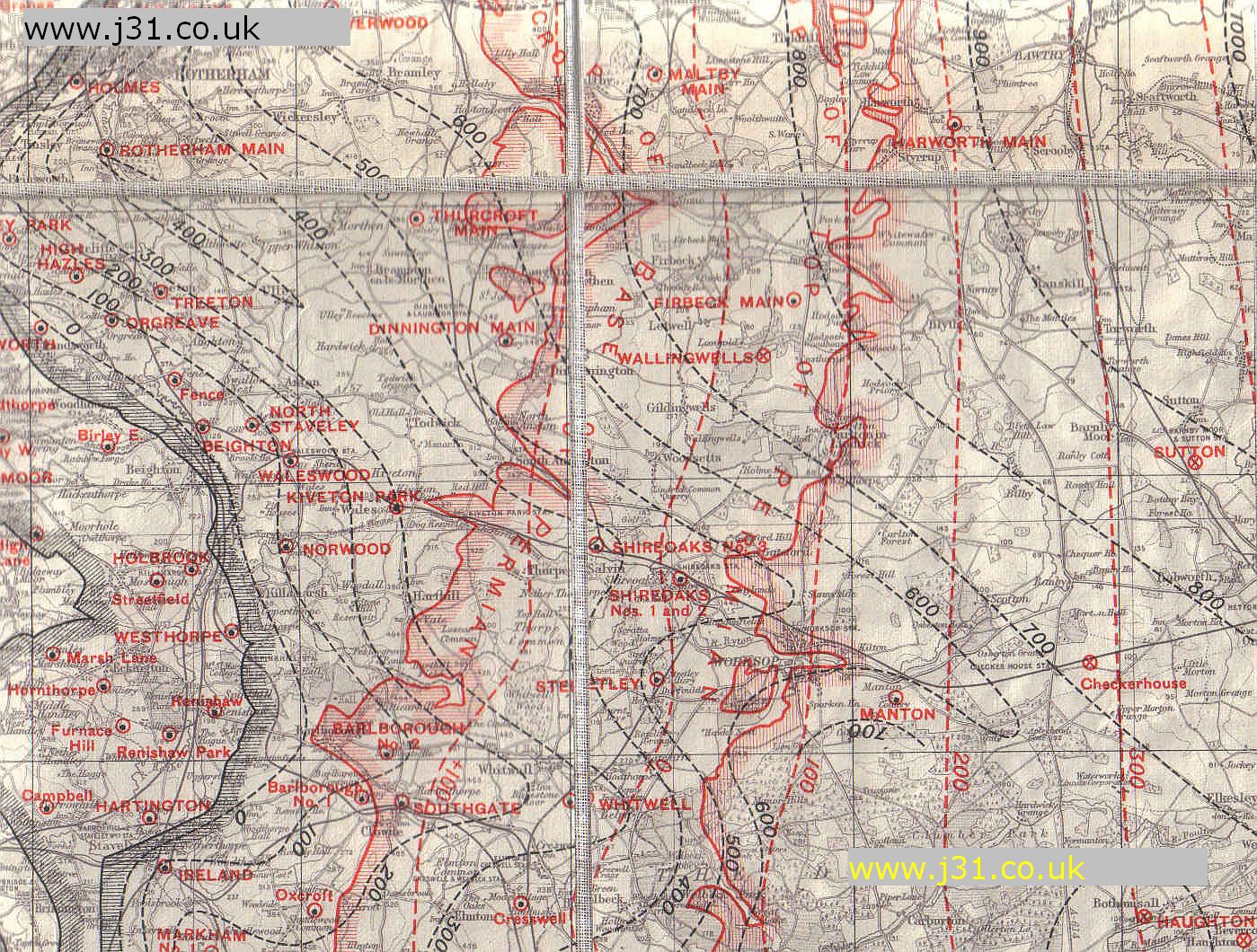
So, if the Yorkshire Coalfield is the area of concealed coal seams, where is the demarkation of the South Yorkshire and West Yorkshire Coalfields relating to The Yorkshire Coalfield? I always believed that The Yorkshire Coalfield was a part of the Yorks Derby Notts and included West, South and some small part of North Yorkshire. I always considered that Barnsley was (is) in the middle of the Yorkshire Coalfield (or thereabouts).
Within twenty minutes walking distance of where I live (on the outskirts of Barnsley) I know of at least six places where coal from at least three different coal seams outcrop and a few miles further West at least six other different seams outcrop, The Barnsley Bed as worked at Ricall being one of those. I believed that all the seams worked (or considered workable) East of the Frickley Fault and within the Doncaster area were all initially worked at their outcrop in the Barnsley area or to the North West.
|
|
|
|
Post by John on Jan 17, 2012 7:48:12 GMT -5
|
|
|
|
Post by John on Jan 17, 2012 7:58:54 GMT -5
Like you Daz, I was under the impression the Yorks/Notts was a distinct coalfield, in fact add the Derbyshire too as it's the western edge of the seams I worked in albeit given different names at most Derbyshire pits.
I know my old pit to the south west, the seams were on the rise, Deep hard could only be worked as far as near Ruddington as were pretty close to the Permian Trias, and it showed with the amount of water peeing in. In a geology book I downloaded from Google Books, there is a geology map showing the Permian crops out just passed Ruddington, south west of Nottingham.
Everything dips to the east and south east at about 1:6 to 1:8 or thereabouts.
Not sure about the South Derbyshire or Leicestershire coalfields, I think they were a separate formation.
|
|
|
|
Post by bulwellbrian on Jan 17, 2012 8:35:52 GMT -5
THe North Derbyshire, Nottinghamshire & Yorkshire coalfield were all the same geological formation. The seams outcrop in the west of both North Derbyshire and Yorkshire. The seam names used in North Derbyshire are generally the same as those used in Nottinghamshire. The Yorshire names differ. There is an area in the far north of Derbyshire and Nottinghamshire where Yorkshire names are used.
The Vale of Belvoir is a continuation of the Nottinghamshire coalfield.
The coal measures extend to the coast and beyond, this has been established by oil/gas bores, but the depth is very great.
The Leicestershire and South Derbyshire coalfield is a separate formation.
I think the most likely place for any possible new exploration is to the south of Daw Mill in Warwickshire and even into Worcestershire. I have even known it said that there is the possibility of coal under North Norfolk. The NCB/BC also had ideas on a new colliery in South Wales at Margam.
|
|
|
|
Post by bulwellbrian on Jan 17, 2012 8:41:36 GMT -5
Another thing, I understand that the Selby complex was only allowed to work the Barnsley seam because of fear of subsidence in the flood plain of the River Ooze.
|
|
|
|
Post by dazbt on Jan 17, 2012 9:39:25 GMT -5
|
|
|
|
Post by Wheldale on Jan 17, 2012 13:19:35 GMT -5
Another thing, I understand that the Selby complex was only allowed to work the Barnsley seam because of fear of subsidence in the flood plain of the River Ooze. Yeah alot of the vale of York is only a meter or so above sea level and the area around Selby is famous for flooding. |
|
|
|
Post by dazbt on Feb 5, 2012 10:06:09 GMT -5
|
|
|
|
Post by Wheldale on Feb 5, 2012 11:16:28 GMT -5
I grew up in Snaith. There is a massive coalfield there. Its probabley the only way Kellingley can go. I Bet the locals will fight if there is a application put in. The area the newspaper talks about is flat and just above sea level. Gowdall is built on a flood plane, back in 2001 when the are was flooded Gowdall was the worst flooded place in the UK. Out of 200 houses 198 were under water.
Askern Colliery mined under Pollington so that area has seen mining before. Its a massive coalfield with massive potential, shame Thorne was filled in as it could have worked the area too.
|
|
|
|
Post by Wheldale on Feb 19, 2012 17:30:10 GMT -5
I read on the Welsh forum that the shafts at Wistow, Riccall and Stillingfleet at Selby were never filled, only capped. I wonder if one day they will be opened back up for the other seams? Alot of the hard work would be done already regarding shaft sinking, the shafts obviously are of a modern diameter. I would think the pit bottom would be in a good condition too. Just need a cross measure drift to theother seams.
|
|
|
|
Post by John on Feb 19, 2012 18:04:22 GMT -5
They were only designed for men and materials though, all coal went up the drift on a Cable Belt.
|
|
|
|
Post by Wheldale on Feb 20, 2012 3:17:28 GMT -5
Wouldnt it be easy to convert them? All the hard work has been done already?
Also, Gascoinge wood drifts would just be capped, cant imagine them being filled in totally, i wonder if as the roadways are under the coal seams if they would remain in an ok condition?
|
|
|
|
Post by John on Feb 20, 2012 6:53:10 GMT -5
Depends on the diameter, they were deigned to carry just a cage, they may well have limits to skip size, which might render them usless for high production.
As for roadways, chances are they are all closed up now, due to water damage and convergence. Water causes strata damage, they may be OK, the only way of finding out is to open a cap up, pump them out and go in to find out.
There's another problem, pumping out, would cost millions and a couple of years.
|
|
|
|
Post by dazbt on Feb 20, 2012 16:23:16 GMT -5
I wonder if any coalfields actually worked more individual coal seams than in Yorkshire? It would be interesting to compare the number of "worked" coal seams in all of the recognised individual coalfields ........ any claims to the number of seams more than Yorkshire, maybe Wales or the North East?
|
|
|
|
Post by John on Feb 20, 2012 17:16:09 GMT -5
Nott's and Derbyshire worked a fair few Daz.
Top Hard, High and Low Hazles, Deep Soft, Deep Hard, Tunsil, Piper's, Tupton, Ashgate, Blackshale...Waterloo, Three Quarter, Yard, Low Bright, Main Bright, Clowne, Furnace, Cinderhill.... I have the full list of seams in the Nott's series, but not sure if any of the other named seams were worked.
Yorkshire had the top series of seams that are missing in Notts, and Derbyshire though.
There are the very bottom seams just above the Millstone grit, from bottom up, Baslow, Belperlawn, Holbrook, 2nd, and 1st Smalley, Forty Yards...I doubt any of those were worked.
|
|
|
|
Post by John on Feb 20, 2012 18:38:10 GMT -5
Here's a list of the named Notts coal seams in descending order.
High Main.
Clowne.
Main Bright.
Abdy.
High Hazel.
Cinderhill. (Coombe?)
Top Hard. (Barnsley Bed)
Dunsil.
!st Waterloo.
2nd Waterloo.
1st Ell.
2nd Ell.
Deep Soft.
Deep Hard.
1st Piper.
2nd Piper.
Tupton. (Low Main)
3/4.
Yard.
Ashgate.
Blackshale.
Mickley.
Kilburn.
Wingfield Flags.
Horton.
Alton.
The bottom seams in my last post were the Derbyshire names for the above seams.
Below the Alton was a thick sandstone bed, Millstone Grit??
|
|
|
|
Post by garryo on Feb 21, 2012 7:24:09 GMT -5
Here is a list of Durham seams, Northumberland had the same seams although like Notts and Derbyshire sometimes under different names.
The NCB tried to standardise the seam names both in Durham and Northumberland by giving the seams index letters starting from the uppermost seam downwards as follows;-
A Hebburn Fell, B Usworth, C Ryhope five quarter, D Ryhope Little, E High Main, F Main,G Yard, H Maudlin, No I, J Low Main, K Brass Thill, L Hutton, M Plessey or Ruler, N Harvey, O Hodge, P Tilley, Q Busty, R Threequarter, S Brockwell, T Victoria, U Marshall Green, V Ganister Clay (coal seam).
This is the bottom of the true seams, below that (Millstone Grit) lay the limestone coals workable seams included the Little Limestone, Shillbottle and a couple of others.
Of the 20 or so true coal measure seams most were worked BUT not all at all collieries. Most would have worked about 12 or so.
The lower seams in the West were high grade coking coal which tended to thin going deeper to the East.
Under the sea at say Wearmouth the Q or Busty seam was a split seam with the top Busty being about 3ft at over 2000ft deep but was not worked, this colliery worked the seams from C Ryhope fivequarter (entered but not worked) to the N or Harvey seam, When Wearmouth closed the workings were 11kms out to sea working the 6-7ft double G or Yard seam getting a very high OMS before closing leaving about 200 million tons between Westoe and Easington including Wearmouth.
|
|
|
|
Post by John on Feb 21, 2012 8:00:51 GMT -5
Quite a few seams Garry, I wonder how they correlate to the Yorkshire seams...
Just to show how shallow some of the seams in Nottingham were to the west, first seam noted in shaft sinkings was the Cinderhill at 190ft 8ins at 32 inches thick. The Top Hard was at 219ft 8ins and 71 inches thick, pity it was so wet, good coal and nice thick seam.
At Wollaton, a mile north of Clifton and slightly to the west Cinderhill seam was 27ft 2ins deep and 24 inches thick, the Top Hard was at 38ft 4 ins deep and 62 ins thick.
Top Hard at Linby Colliery about five miles north east of Clifton was at 433 yards deep! And at Clipstone in North Notts it was 583 metres deep and 183cm thick.
The High Hazels wasn't to be found at Wollaton, Clifton or Radford, but at Gedling to the east, about three or four miles from Wollaton was 375 yards deep and was their main seam for years.
Depth of seams at Cotgrave, noted during shaft sinking were:-
High Main 883ft 4ins 4ft 9ins.
Clowne, no mention.
Main Bright 1029ft 3ins 3ft 8ins.
High Hazels 1151ft 3ins 3ft 2ins.
Top Hard 1296ft 5 ins. 3ft 6ins.
Dunsil. 1356ft 11ins. 2ft 0ins.
1st Waterloo..1382ft 9ins 2ft 20ins.
2nd Waterloo 1407ft 0ins 2ft 0ins.
1st Ell 1505ft 9ins 2ft0ins.
Deep soft 1765ft 11 ins 3ft 4ins......First five faces abandoned in the early 1960s.
Deep Hard 1802ft 9ins 3ft 6ins. Main seam worked.
1st Piper 1858ft 10ins 1ft 6ins.
2nd Piper 1882ft 7 ins 1ft 11ins.
Tupton, (Low Main) 1938ft 2ins 3ft 6ins.
3/4 1946ft 8ins 1ft 7ins.
Yard 2014ft 1ins 2ft 4ins.
Blackshale 2031ft 2ins list as 1ft but obviously a typo as this seam was worked at the collieries finish by a BJD Ace ranging arm shearer, so suspect by photos 10ft thick.
Total shaft depth 2054ft 8ins.
Cotgrave was a couple of miles south of Clifton.
|
|
|
|
Post by bulwellbrian on Feb 22, 2012 10:02:54 GMT -5
Nott's and Derbyshire worked a fair few Daz.
Top Hard, High and Low Hazles, Deep Soft, Deep Hard, Tunsil, Piper's, Tupton, Ashgate, Blackshale...Waterloo, Three Quarter, Yard, Low Bright, Main Bright, Clowne, Furnace, Cinderhill.... I have the full list of seams in the Nott's series, but not sure if any of the other named seams were worked.
Yorkshire had the top series of seams that are missing in Notts, and Derbyshire though.
There are the very bottom seams just above the Millstone grit, from bottom up, Baslow, Belperlawn, Holbrook, 2nd, and 1st Smalley, Forty Yards...I doubt any of those were worked. The Belperlawn seam was worked at Denby Hall and or Denby Drury Lowe in Derbyshire. |
|
|
|
Post by erichall on Sept 3, 2012 12:42:12 GMT -5
The Clowne seam was worked extensively in the North Derbyshire area. A further seam above the Clowne seam was the relatively thin seam of the 'Two Foot' which was in fact around 36 inches, and was worked with some success, and rather extensively at High Moor Colliery in the very North East of the area, coupling up eventually with Kiveton Park after the closure of the N.Derbys. Area. All remaining pits in the N.Derbys were incorporated with the N.Notts Area with the exception of High Moor, which was moved into the S.Yorks Area
|
|